Factual error: Will pulls up a map of Washington DC and surrounding areas, just before selecting cameras to tap into the feed of. With an air traffic overlay showing multiple aircraft directly over the National Mall, Capitol, and White House... all inside the city's strict no-fly zone. One or two could be on official clearance, but this many flights in restricted airspace are unrealistic. (00:00:55)

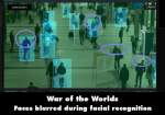
Factual error: Just before the drone shot, the surveillance feed shows a busy city crosswalk, but the on-screen coordinates are 32.443518° N, 169.446082° W, placing the location in the middle of the Pacific Ocean over 1,600 miles from land. Moments later, the same coordinates appear again in the drone footage, revealing that the filmmakers reused the same HUD data for two completely different locations. (00:01:35)